You will also be interested
[EN VIDÉO] The fascinating world of clouds Look at the clouds passing: it comes in all shapes. Here we show you some of them, which reside on different “floors”, as meteorologists say.
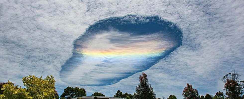
This spectacular hole, which can extend for tens of kilometers, really gives the impression that a ship from another world has passed through a layer of clouds. This phenomenon, which surfaces several times a year in the photos of Internet users, is well known to weather experts.
If theWorld Meteorological Organization recognized him in his cloud atlas and classified as cavity since 2017, the phenomenon has been better known under other names: skypunch, fallstreak hole, hole punch, and in French “trou de virga”. Remember that in meteorology, we call virgas precipitation that does not reach the ground because it evaporates during its descent. the skypunch is actually a evaporating cloud which is in the form of a circle, or a clear line within a layer of clouds. Inside the hole, we can just see fine cloudy wisps, the famous “virgas”.
One skypunch on video with the virgas at its center. © Matthew Marley
Both natural and artificial formation
This phenomenon is the result of two processes, one natural, the other artificial. The hole forms when a plane passes through the cloud, during its ascent or descent: in this specific case, the hole is circular. If the plane passes through the cloud horizontally, the shape of the hole will be rather linear.
A cloud is made up of water droplets supercoolingit means that the temperature is below 0°C, but these drops remain liquids. The passage of the plane causes disturbances, and lowers the temperature very briefly, but very strongly. The drops turn into ice crystals which are then too heavy to remain in suspension, so they eventually fall and evaporate quickly. This is how this hole is formed inside the cloud. This enlarges in a few minutes, then deforms. The formation of this hole can extend over 50 km in the space of an hour. The skypunches sometimes form in groups, as evidenced by the satellite images which can capture more than a dozen scattered on the same cloud band.
Several skypunch over New York. © NOAA
From skypunches sometimes observed in France
the skypunch forms in thin cirrocumulus type clouds, or slightly thicker altocumulus and stratocumulus type clouds, low and thick clouds. Depending on the type of cloud in which it forms, its altitude therefore varies between 1,500 and more than 10,000 meters.
A skypunch captured by NASA satellites. © Nasa
It can be formed anywhere in the world and at any season, but the most beautiful photos of the phenomenon have so far come from Australia and the American continent (USA, Canada, Mexico). Some skypunches have also been photographed in Europe, France and the British Isles in recent years, without being as impressive as those on other continents.
Support an editorial team committed to popularizing science on Patreon!
Our mission ? Return the knowledge accessible to everyone.
We produce our own articles, investigations and reports every day, all on a human scale. Support us in this approach and this ambition.
Subscribe to Futura on Patreon!
Two subscription plans are offered to you with the following advantages:
- ” Futura ad-free »: get guaranteed ad-free access to the entire site for €3.29/month (+VAT).
- ” I participate in the life of Futura »: in addition to access without advertising, take part in the life of our independent media (votes, new content, surveys, etc.) for €6.29/month (+VAT).
Interested in what you just read?
