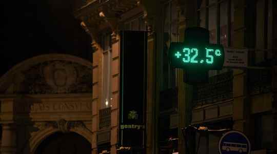
Not less than 22°C in Cannes, 23°C in Avignon, 24°C in Nice… The nights promise to be harsh this weekend and next week for some of the French. After those of June then July, a third wave of heat hit the country, taking with it sweat and rest. Squirming around in search of a bit of nighttime freshness was unusual in France until the 2000s.
Between 1976 and 2005, Meteo France identified throughout the territory, with the exception of the Mediterranean rim, the Aude and the Rhône valleys, less than ten so-called “tropical” nights, during which the thermometer did not display less than 20° Even in the early morning. But like the summer of 2022, these are now multiplying. They could be up to 5 times more frequent in 2100, if States do not reduce their greenhouse gas emissions.
Still poorly considered in the public debate, the lack of nocturnal coolness is nevertheless one of the most salient aspects of global warming. While we often focus on sweltering days, climatologists have recently discovered that weather phenomena at night are more susceptible to disruption than those occurring during the day, particularly in cities. A worrying phenomenon in terms of health.
The night goes wrong faster than the day
Like the Alps, where the climate warms twice as much as in the plains, nighttime temperatures are more intensely disrupted than daytime ones. “Planetary observations show that the average climate change is faster at night. The number of exceptionally hot nights is also increasing faster than the number of days”, explains to L’Express Fabio D’Andrea, research director at the CNRS and climatologist .
Research is still in its infancy on this subject. “Several phenomena could explain this exacerbated nocturnal sensitivity to warming, but we do not know exactly to what extent they act”, continues the climatologist. First avenue explored: the clouds. “Global warming disturbs the cloud cover, but it blocks the heat at night”, sums up the deputy director of the Dynamic Meteorology Laboratory of the École Normale Supérieure (ENS).
During the day, the clouds act as a firewall: they prevent part of the sun’s rays from reaching the ground. In other words, they limit the heat. At night, it’s the opposite. Clouds block the heat released by the rocks, earth or bitumen of our soils, and accentuate the warming. However, climate change tends to drive out daytime cloud cover and increase nighttime cloud cover, according to a study published in September 2020 in Global Change Biology.
Another more complex phenomenon could participate on a larger scale. The layer of atmosphere in which we live acts as a boundary with the rest of the air, which is sometimes much warmer. During the day, this mass extends up to 1000 meters high. At night, this layer retracts, and only occupies a few hundred meters. Denser and weaker, it would then be more permeable to heat, according to a study published in 2016 in International Journal of Climatology.
An accentuated phenomenon in the city
These imbalances affect us right now. Consequences: the people of Montpellier and Perpignan already suffer five more “tropical nights” than during the period from 1981 to 2010, and the inhabitants of the Var ten more, according to Météo France. On June 28, the institution adopted new seasonal normals, in particular to take account of this increase. If the south is particularly affected and risks living up to three months of uninterrupted nights, city dwellers are also bearing the full brunt of these mechanisms.
Heat islands, these urban areas where the mercury rises faster than elsewhere, act mainly at night. “During the day, the air temperature is equivalent in air temperature in the city and in the countryside. There is of course a difference, linked to the absence of shaded areas and to the materials, but the heat in the air will be the same”, indicates Valéry Masson, researcher at the National Center for Meteorological Research and at Météo France.
During the first heat wave of 2022, scientists from the CNRS, Météo France and around thirty universities around the world measured with unprecedented precision the “thickness” of the nocturnal urban heat island in Paris. On June 17, at the quays of Bercy, in the heart of the city, the air temperature still rose to 31°C at 8 p.m., against 24°C in the Bois de Vincennes. At 10 p.m., the temperature difference between the city center and the outlying areas reached 5 to 7°C.
“Unlike plants, urban materials store heat. The walls remain warm, because of their composition. Then this heat is released at night, in the form of radiation and by contact with the air”, explains Valéry Masson. The shape of cities also acts. “During the night, in the steep-sided streets, the walls have less direct access to the sky. The heat is therefore released towards another wall, instead of being evacuated”, continues this urban climate specialist.
These “tropical nights” are more worrying than it seems. Scientific literature tends to show that warmer nights have a longer lasting impact on health than hot days. From 25°C, the probability of not enjoying restful sleep is multiplied by 3.5, according to a Danish study carried out on 47,000 people and published in May 2022 in the journal One Earth. And according to a study carried out by Public Health France and published in 2011 in International Journal of Climatologythe less cold nights of the 2003 heat wave were more deadly than the hottest days.