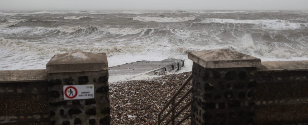
After the passage of storm Ciaran over the north-west quarter of France this Thursday, November 2, 2023, two other depressions are announced between this evening and Saturday.
After the passage of storm Ciaran, eight departments remain on orange alert, but none of them for violent winds, this Thursday, November 2. At the same time, two other depressions are expected to cross the France. How long will they continue? The last storm is expected to cross France this Saturday, November 4. The weather is therefore expected to be choppy until the end of the weekend.
It is in the Bay of Biscay that the first depression will begin. “Heavy rain” and “strengthening winds” are expected, according to Météo-France which also specifies that this storm will fade tomorrow, Friday November 3, before leaving France. The depressions will not stop there: the storm named “Domingos” should also reach France. It will mainly affect the Atlantic coast, with violent winds, heavy rain and significant waves. The weather will remain choppy until Sunday, November 5.
Why do depressions keep coming?
The country has now been experiencing turbulent weather for more than two weeks. How to explain this phenomenon ? “Low pressure rails” are currently present over France: depressions follow each other closely because they are under the influence of a “zonal flow”, that is to say a “jet stream”. The latter is currently very powerful, as it blows at more than 300 km/h and is heading towards the country. The current jet stream has other particularities: its flow has been uninterrupted for more than two weeks and its trajectory is rectilinear, which makes recent storms more violent. “This situation is explained by a west to southwest current which is well anchored in Europe,” explains Météo-France, which specifies that this current “acts as a highway for disturbances which can circulate freely. “.