The sovereignty of several States still violated. Inherited from the wars against the colonial powers and the takeover of the Chinese Communist Party (CCP), the border disputes of the People’s Republic of China with its neighbors are numerous. However, Beijing does not seem to be determined to want to ease the tensions. And for good reason: the Chinese Ministry of Natural Resources put online, on August 28, the 2023 edition of the official map of the country. An arbitrary route that seems to ignore international law since it encroaches on the perimeter of some of its Asian neighbors – India, Malaysia, the Philippines, Vietnam and Taiwan – and even of its Russian ally.
Concretely, these new delimitations show that China is cutting corners on the Philippine, Malaysian and Vietnamese maritime zones in the South China Sea, on the state of Arunachal Pradesh in northeastern India – which China considers to be part of the Tibet – but also on the island of Bolshoi Oussuriisk. On this new map, Beijing also appropriates the Aksai Chin glacier, bordering India and which has been the source of tension between the two countries for decades. Unsurprisingly, however, Taiwan, which Beijing plans to reconquer, is also placed on the space belonging to China. This symbolic illustration of the expansionist policy of the country led by Xi Jinping has something to ruffle the hair of some neighbors.
Violations of international law
The reactions quickly fused. Starting with India, which on Tuesday sent a “strong protest” of this card through diplomatic channels to China. “We reject these claims as they have no basis. Such steps taken by the Chinese side only complicate the settlement of the border issue,” Foreign Ministry spokesman Arindam Bagchi said. India is concerned about its neighbor’s military expansion and their shared 3,500 kilometer long border is a constant source of tension.
For New Delhi, the state of Arunachal Pradesh and the Aksai Chin glacier belong to India. Occupied by Beijing but claimed by New Delhi, the second was the subject of armed clashes between the two countries in 2020. As underlined the newspaper The cross, “This historical conflict is linked to the rough and unrecognized course of Communist China, established in 1914 between the British Empire and the then independent Tibet”. Regarding Chinese claims in the South China Sea, we can distinguish a line of ten dotted lines starting from Taiwan, descending along the Philippine coast and then along the Malaysian and Vietnamese coast.
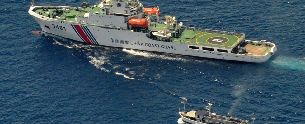
For their part, the Philippines denounces a route having “no basis under international law”. Same story in Vietnam: the spokesperson for the Vietnamese Ministry of Foreign Affairs, Pham Thu Hang, considered on Thursday August 31 that this “dotted line” was a violation of Vietnam’s sovereignty over Hoàng Sa and Truong Sa under the United Nations Convention on the Law of the Sea of 1982. As for Malaysia, if it recognizes, according to the economic daily Nikkei Asia, that the subject is “complex and sensitive”, she nevertheless considers that this document has “no binding effect”. Faced with challenges from its neighbors, the Chinese Minister of Foreign Affairs justified himself on Wednesday: “The publication of the 2023 edition of the standard map of China and a normal exercise of the sovereignty of our country. We hope that the parties concerned will deal with it objectively, without overinterpretation.”
Technical problem”
What is most surprising about this new map is the Chinese desire to claim, on paper at least, part of the territory of its Russian ally: Bolshoi Ussouriysk Island, yet shared between Moscow and Beijing since 2008 after more 100 years of border conflict. Three days after the publication of the map, the spokeswoman for Russian diplomacy Maria Zakharova wished to defuse any suspicion of provocation on the part of Beijing with regard to Moscow. As reported by the Russian media group RBK, Maria Zakharova specified that the border question between Russia and China was “definitely settled”, and this “for both parties […] after several years of efforts on the part of the two countries”.
A Russian diplomatic source even went so far as to explain to RBK that this situation was due to the fact that “China has still not obtained the settlement of border issues with several neighboring countries. However, according to Chinese practice, the introduction of modifications to the cartographic tools are not made piecemeal but in a group fashion – the last time therefore dating back to 1989”. And to add that it was a “technical and not a political” problem.
