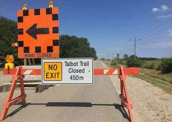

After multiple deputations and a spirited discussion, Chatham-Kent councilors opted for a third option to deal with the future of Talbot Trail.
Council ultimately decided Monday to only file the environmental assessment report for the Phase 1 component, which encompasses 2nd Concession Line to Stevenson Road, as opposed to the larger stretch from 2nd Concession to Craford Road.
Council also endorsed the first phase to reopen Talbot Trail in the area currently closed.
BT Engineering conducted the study, which discussed relocation options for the roadway.
South Kent County. Trevor Thompson said reopening Talbot Trail in the Coatsworth area is the priority, noting the ongoing impact of the closure to businesses and farmers.
He asked staff how long it would take to have that stretch built and reopened.
Chris Thibert, director of engineering and transportation, said it was difficult to gauge the timeframe, but said it could be completed within the next couple of years.
“There will be some land acquisition required for this first phase,” he said. “That could be a quick process. It could be a long process, depending on how the land purchasing proceeds.”
Thibert said public feedback would be sought, followed by detailed design and construction tendering.
“It could be a road open by 2024. It could be a road open by 2025,” he said. “I don’t see anything happening in 2023.”
As for the larger corridor that was proposed, Thompson said he wasn’t prepared to proceed with that, given the extensive timeframe and significant impact.
“There’s so many unknowns when you introduce timelines of 50 to 100 years,” he said, noting the potential change in technology, as well as priorities, in the coming decades.
Citizen deputations earlier in the meeting also mentioned how focusing on a smaller stretch of roadway would be more appropriate.
According to a staff report, the third option that council selected will only document separately the hazard zone for Phase 2 that was proposed by this study.
“It could be considered for land-use protection for future development at some future date, but it would not protect the corridor now and would defer any action to a future council,” the report stated.
The alternate approach will require additional consulting fees in the amount of $20,000, plus HST, with the money to come from capital funds.
Steve Taylor, the consultant from BT Engineering who gave the presentation, said climate change and storm events have worsened coastal erosion.
He called it crucial for municipalities to monitor conditions and availability of funding from senior levels of government.
Talbot Trail was formerly a provincial highway before it was downloaded to the municipality in the late 1990s. In 2019, municipal officials closed a portion of the road near Coatsworth because erosion from Lake Erie had damaged its structural integrity.
In 2010, the municipality had to build a $200,000 bypass in the same area after nearby bank erosion caused a major crack in the road.