PROVINCE OF UTRECHT – A weather warning in the province of Utrecht will be in effect tonight due to a possible storm. It will not be as heavy as storm Eunice, but especially in the course of the evening the wind gusts in the province can reach 100 kilometers per hour. That is why code yellow applies between 8 p.m. and 1 a.m., the KNMI reports. In the coastal province it is even code orange.
We should even prepare for possibly the third official storm in a week and the fifth of this year, because on the west coast there is a chance of wind force 9 (storm) and very strong gusts of 90 to 120 kilometers per hour. If it storms for an hour on average, it is called an official storm.
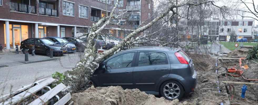
“Whoever still has loose items in the garden in the aftermath of Eunice would do well to clean them up today,” says meteorologist Matthijs van der Linden of Weeronline. “Flying objects can cause new damage tonight. Loose branches can also blow out of trees and weakened trees that have just failed to die on Friday may still receive the fatal push.”
Also very turbulent on Monday
In the night to Monday the wind will decrease slightly, but it will remain very turbulent with strong winds and in the west there is a chance of heavy gusts of 80 to 90 kilometers per hour. At sea it remains stormy. “From Tuesday, the chance of a storm has disappeared and we no longer have to take very heavy wind gusts into account. It can occasionally still blow quite a bit, but we are now used to that,” says meteorologist Matthijs van der Linden.
The vaccination location Power Station on Amerikalaan in Utrecht’s Kanaleneiland will close an hour earlier today. “We do this for the safety of visitors and employees because stormy weather is predicted later in the evening,” according to the GGD.
Do you have a tip or comment? Send us your news or photo via whatsapp or email.