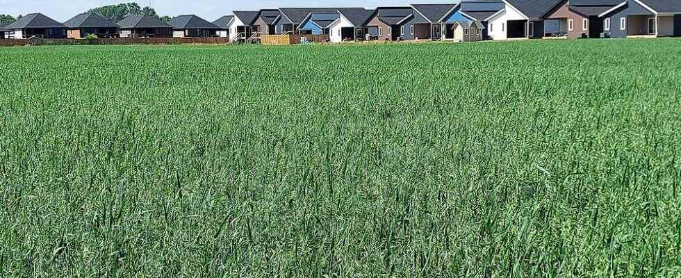
Use of land for agriculture in Chatham-Kent grew by more than 44,000 acres over a five-year period, according to the 2021 census of agriculture, but a member of the Ontario Federation of Agriculture is questioning the accuracy of the numbers.

Agricultural land use in Chatham-Kent grew by more than 44,000 acres over a five-year period, according to the 2021 census of agriculture, but a member of the Ontario Federation of Agriculture is questioning the accuracy of those numbers.
The data shows Chatham-Kent had 634,681 total acres in use for agricultural purposes in 2021, which was up exactly 44,335 acres from 2016. Looking simply at land for crop production, the increase was more significant at an extra 45,132 acres.
In contrast, natural land for pasture dropped by more than half to 1,455 acres.
Across Ontario, farmland declined by more than 580,000 acres, but cropland increased slightly. The province’s biggest losses were in the woodlands and wetlands and the pastureland categories.
Chatham-Kent’s total farmland area raises a question, as the municipality’s entire area is just less than 608,000 acres.
Crispin Colvin, an executive member of the Ontario Federation of Agriculture, said the numbers don’t seem to make sense.
“Somewhere there are 27,000 acres disappeared, and that’s on the assumption that there is no building, no city – Blenheim doesn’t exist, Chatham doesn’t exist, it’s all farmland,” he said.
“I think somewhere the numbers have been incorrectly input, is my guess.”
However, the reason may be in a rule the census regularly follows to collect this data.
Jadyn Yelle, communications officer for Statistics Canada, said the census of agriculture “assigns all data collected for an agricultural operation to a single main farm location, as reported by the census respondent.”
“This is what we call the ‘farm headquarters rule,’ and it has been used for many censuses,” Yelle said in an email. “This methodology is applied to all agricultural operations in Canada, including those composed of numerous parcels of land located in different geographic areas (such as rural municipalities or counties). This means that all of the farm area will fall into one single location for dissemination purposes.”
Yelle said this rule could create some inconsistencies in terms of how land is allocated to different jurisdictions.
Colvin, who is also the federation’s director for Middlesex and Lambton counties, said he expects municipalities will also question Statistics Canada over the numbers.
“They are marketing their area in terms of people living there or tourism,” he said. “They want to attract people, so they need it to be accurate. They don’t want false information being floated in the public domain.”
The loss of tree coverage in Chatham-Kent does not appear to account for the increase in farming. While not a direct comparison to the census data, a recent local study showed the municipality’s forested area decreased by nearly 400 acres between 2015 and 2020.
The jump in farmland also occurred over the same time that the Municipality of Chatham-Kent has reported record building permits, including new subdivisions. The municipality does not conduct its own analysis of the census of the agriculture.
Yelle said numbers work out to a 7.5 per cent increase in total farmland for Chatham-Kent, driven by an 8.1 per cent increase in cropland.
“A similar finding was reported across Ontario and across Canada. From 2016 to 2021, cropland increased by 0.3 per cent in Ontario while its total farm area declined by 4.7 per cent. This trend was reported across Canada which suggests a greater intensity of use of agricultural land,” Yelle said.
“Hence, the decline in natural land for pasture in Chatham-Kent between 2016 and 2021 suggests that the trends could potentially be driven by changes in land use. It may be possible that land was sitting idle in 2016 and is now being put-to-use.”
Colvin said there has been more of a demand for crops in Southwestern Ontario.
“More people want local produce, so farmers are recognizing that and they are going into more of it as well,” he said. “There is land being shifted in terms of what we grow this year might not be the same as what we’re going to do next year.”
Elgin County and Middlesex County were the only other areas in southern Ontario that saw an increase, with an additional 11,991 and 12,686 acres, respectively.
Colvin said Chatham-Kent is one of the “finest” areas in the province for farming, and most of the best land is located in Southwestern Ontario.
“Because commodity prices have come up, despite the fact that fertilizer prices and input and fuel and everything else has gone up with it, makes it a more interesting or perhaps a more viable product,” he said.
“Some of the marginal land that might be around that people have left fallow, for example, may be brought into production that wasn’t before, just because crop prices might make it worthwhile.”
