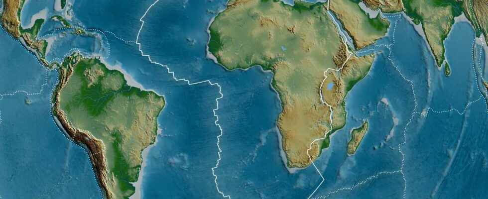
Terrestrial specificity, the crust of our Planet is divided into numerous tectonic plateswho have the ability to moveunder the impetus of the convection mantle and major tectonic processes: accretion oceanic and subduction. Whether the cutting of the main plates is now a consensus, there are however several models which present, in detail, many configuration variations at the level of the plate boundaries.
The tectonic plates, puzzle pieces with still blurred contours
Because the Earth’s crust can be likened to a puzzle whose outline of the pieces is still poorly understood. The exact definition of the plate boundaries is however a major point to carry out precise reconstructions of the movement plates and understand how they got alternately welded then separated, during the major tectonic cycles experienced by the Earth. In addition, plate boundaries always represent areas of intense deformation, associated with tectonic or magmatic processes. They can be extensive — and thus mark a zone of oceanic accretion –, compressive — in which case they can be associated with a subduction zone or a mountain range — or in shear. The typical example of the latter case is the San Andreas Fault in the United States, an area susceptible to very large earthquakes.
Knowing in detail the characteristics of these different plate boundaries and precisely defining the extension of the deformation zone is essential to estimate the geohazard to which the populations living in these regions are subjected.
New knowledge finally integrated into tectonic maps
A team of researchers from the University of Adelaide, Australia, therefore looked into the construction three new world maps: configuration of tectonic plates, configuration of major geological provinces and configuration of mountain ranges (recent or ancient). This is a database very complete and essential to carry out many studies.
The map of tectonic plates had not been revised since 2003. However, since then, many advances have been made, in particular on the definition of new microplates such as that of Macquarie, located in the south of Tasmania, but also the Capricorn microplate which separates the Indian and Australian plates. The great novelty, however, is to be found on the side of the west coast of North America, where the active deformation zone attributed to the San Andreas and Queen Charlotte faults has been enlarged compared to previous models. It now extends over 1,500 km.
The new maps also more adequately illustrate the large deformation zone affecting Central Asia, linked to the punching of India into the interior of the Eurasia continent. This major collision, which is at the origin of the Himalayan range and the highest peak in the world, Everest, indeed impacts a very large area in Asia which is regularly subject to earthquakes.
Better integration of seismic and volcanic events
The results of the study have been published in the journal Earth-Science Reviews. By integrating a large amount of data (GPSearthquakes, fault lines, anomalies of gravity and magnetic anomalies, geochronology, etc.), these new maps make it possible to better explain the distribution and origin of 90% of earthquakes and 80% of volcanoes over the last two million years. By comparison, older models only captured 65% of earthquakes.
Special offer: for Father’s Day, offer the best of Science!
Your father is a great science enthusiast and unusual discoveries? And if you offer him a superb scientific exploration in paper format? Benefit from -20% on the Mag Futura (special offer: €15 instead of 19 €): 220 pages to explore 4 scientific issues that will shape our future!
Mag Futura is:
- 4 major scientific questions for 2022, from the Earth to the Moon
- 220 pages, 60 experts: no fake news, just science
- Home delivery with electronic gift card
- An independent scientific media
Interested in what you just read?
