A few snowflakes come across the northwest quarter of the country of France this Friday, February 7, but snowfall must intensify tomorrow and move to the center and the south of the country.
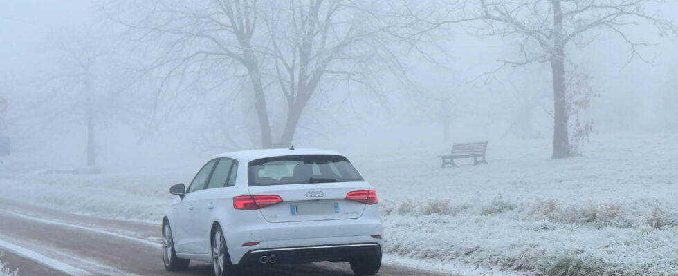
The snow is back in France from this Friday, February 7 and for the whole weekend. A wet and winter weather caused by an east flow from Germany and a cold drop, that is to say a cold air pocket at altitude that will bring snow and rain. But the meteorological episode starts timidly this Friday in the north-west of France: “Rain showers, or rain and snow mixed, circulate Cotentin in the north of Brittany. […] Low snow or rain and snowfall and snowfields occur in the morning of the heights of Pas-de-Calais, at the Norman hills, in the north of Ile-de-France and the Perche “, specifies Météo-France in its bulletin this Friday.
The snowers had to focus on the Orne, the Oise, the Pas-de-Calais and the Somme according to its morning bulletin, but the last three departments of this list left the vigilance area in the middle of the morning. Where a few snowflakes fall, the temperatures do not allow them to hold on the ground, except in places. In the Orne, “the cumulators can locally reach 5 centimeters”, but this is an exception.
If 20 yellow vigilances are activated for snow and ice this Friday, “a passage in orange alert is not envisaged” assures Météo France. The fact remains that “temporary difficulties on road axes are possible”. The alerts mainly affect the northwest quarter of the country, from Hauts-de-France to the south of the Pays de la Loire, but also Ardèche and Lozère in the Southeast and the Hautes-Pyrénées and Pyrénées-Atlantiques in the southwest.
No more snow expected on Saturday
The snow will however be present in greater quantity for the day on Saturday. Rainless and snowy showers will focus on Normandy and Brittany in the northwest, but especially in the center and south of the country near the Massif Central and the Pyrenees. Four departments will also be placed in orange vigilance: Ardèche, Aveyron, Haute-Loire and Lozère. 23 others will be on yellow alert.
The forecasts announce from Limousin snow to the Center region with a few centimeters on the ground. The snow will also fall on the Massif Central. During the night, on the Limousin and the west of the Massif Central, the flakes will fall from 600 to 800 meters. From Puy-de-Dôme, to Haute-Loire via the Cévennes, no one will be spared. The snow will reach 20 to 30 cm from 1000 m altitude, and up to 80 cm (locally 1 m) in Lozère and on the Ardèche summits.
Saturday morning, the Loire, Haute-Loire, Ardèche and Lozère will be the most affected by this snowy episode, from 600 meters. Météo-France announces a strengthening of the disruption on Saturday with marked precipitation, especially on the Cévennes, and in the form of snow at low altitude, with a rain-snow limit which should be around 400 m on the Auvergne and the ‘Aveyron, 700 m on the Cévennes, 500 m on the Pyrenees. Snowfall could also touch the center-east at very low altitude. However, the evolution remains to be specified for the rest of the day on Saturday and more generally of the weekend, in particular following the uncertain positioning of cold drop.
12:35 – 27 departments on alert on Saturday, several affected regions
A total of 27 departments will be on alert on Saturday, including 4 in orange alert: Ardèche, Aveyron, Haute-Loire and Lozère. The majority of the territories concerned by the yellow alerts are at the center and in the south of the country: the Loire, the Puy-de-Dôme, the Isère, the Drôme, the Hérault, the Gard, the Creuse, the Corrèze, the High -Aly, Cantal, Lot, Tarn, Ariège, Haute-Garonne, Hautes-Pyrénées and the Pyrénées-Atlantiques. It also takes six vigilances to the northwest: Orne, Manche, Côtes-d’Armor, Ille-et-Vilaine, Mayenne, Loire-Atlantique and Maine-et-Loire.
12:16 – Orange vigilances for snow and the ice announced
In its midday bulletin, Météo France does not announce any change for day forecasts, but it provides four orange “snow-verglas” vigilances for Saturday. It is the nearby or influenced departments for the weather of the Massif Central, and already on yellow alert this Friday, which will be concerned: Ardèche, Aveyron, Haute-Loire and Lozère.
12:08 – The snow -vert alert removed in eight departments
In its latest bulletin, Météo France withdrew the yellow alert for snow and ice in eight departments: La Somme, Oise, Vienne, Val-d’Oise, Les Yvelines, Essonne, Eure-et -Moir and Indre-et-Loire. For its part, the Haute-Loire joins the list of departments placed in yellow-red-Verglas yellow vigilance.
There are now only 20 departments on alert for snow-Verglas according to the Meteorological Agency: Pas-de-Calais for Hauts-de-France; Eure, Seine-Maritime, Calvados, Orne and Manche in Normandy, Ille-et-Vilaine and the Côtes d’Armor for Brittany, but also Mayenne, Sarthe, Loire-Atlantique , Maine-et-Loire, Deux-Sèvres and Vendée. To these departments in the North West and West, there are six other territories: Ardèche, Lozère, Aveyron, Haute-Loire, Hautes-Pyrénées and the Pyrénées-Atlantiques.
10:33 – Several alerts raised by Météo France
If Friday morning 25 departments were placed in yellow vigilance for snow and ice, from the middle of the morning they are only 20. Several territories came out of the alert perimeter, while others entered it. Vigilance was lifted in the Somme, Oise, Val d’Oise, Yvelines, Essonne, Eure-et-Loir, Indre-et-Loire and Vienne. Conversely, it was activated in Aveyron and Haute-Loire, nearby neighboring departments and influenced by the time of the Massif Central.
08:59 – A little snow in the plain this Friday, more this Saturday
Snow is expected this Friday. If several tens of centimeters of snow are announced in certain regions of the Massif Central – between 30 and 40 centimeters in Lozère according to the weather chain – but these forecasts only concern the territories at altitude, above the 1,400 meters. The fact remains that the snow will also fall into the plains, especially in Normandy, in the Hauts-de-France, a part of Ile-de-France, but it will not be able to hold on the ground. Just 1 to 3 centimeters could resist in the hills in the face of fresh but positive temperatures.
Snowfall could be more important on Saturday. They will then receive more the surroundings of the Massif Central than the North West and will be visible at lower altitude, the rain-snow limit should lower around the 500 meters.
08:11 – More than twenty departments placed in snow -green alert
Météo-France has placed twenty-five departments in yellow vigilance for snow-Verglas in its Friday morning bulletin: Pas-de-Calais, Somme and Oise for Hauts-de-France; Val d’Oise, Yvelines and Essonne for Île-de-France; Eure, Seine-Maritime, Calvados, Orne and Manche in Normandy, Ille-et-Vilaine and the Côtes d’Armor for Brittany, but also Eure-et-Loir, Mayenne , Sarthe, Loire-Atlantique, Maine-et-Loire, Indre-et-Loire, Deux-Sèvres, Vendée and Vienne.
To these departments of the North West and West, there are four other territories: the Ardèche, the Lozère, the Hautes-Pyrénées and the Pyrénées-Atlantiques.