FOREST WEATHER. The forest weather forecast has been officially launched since Friday, June 2, 2023. The fire risk map is published daily by Météo France to prevent fire risks during the summer.
Forest weather is on! The map assessing the risk of fire everywhere in France was unveiled on Friday June 2 by Météo France and it is the first of a long series. Daily and until October, the tool is updated to inform the French and prevent fire outbreaks.
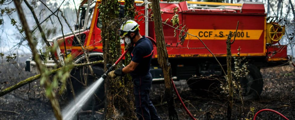
On the occasion of the launch of the forest weather forecast, Emmanuel Macron goes to Nîmes (Gard), on the civil security air base, on June 2, to “prepare for the summer” and ensure that the measures of firefighting announced last fall “are well implemented on the ground”. After a summer of 2022 ravaged by flames, the coming summer season promises to be equally difficult: 21,000 hectares have already gone up in smoke between January and May, compared to 15,000 last year over the same period, noted a presidential adviser To BFM TV. “72,000 hectares including 60,000 hectares of forest went up in smoke” last year recalled the Minister of Ecological Transition Christophe Béchu on April 25, who added that he wanted to avoid the loss of as many hectares. However, the continuing drought is likely to increase the risk of fire. Forest weather must therefore make it possible to “prevent, anticipate and inform” about the risks of forest fires, of which “90% are of human origin and approximately more than half come from stupid gestures: cigarette butts, barbecues, grinder”, underlined the Minister.
How will forest weather work?
Every day, from June 1, 2023 and at least until the end of September, the forest weather report will specify department by department the degree of fire risk. Thanks to a scale system and a well-known color code, the French will be able to know at a glance if their region is prone to fire outbreaks. Four alert levels are provided:
- Green: low risk when “forecast weather conditions and the latest precipitation mitigate the risk of starting and spreading forest fires”.
- Yellow: moderate risk
- Orange: high risk
- Red: very high risk “compared to summer normals”.
These alerts could be accompanied by certain preventive measures or messages to adopt behaviors adapted to the situation. “The hotter it is, the drier it is, the higher the risk of fire. We define risk thresholds, which are both in intensity and geographical coverage. [Le niveau d’alerte] must already be a first warning signal on the fact of taking the necessary precautions”, detailed Virginie Schwarz, the president and director general of Météo France at a press conference. Note that if an alert concerns an entire department , certain subtleties may be taken into account, specified the boss of the meteorological institute: “For example, when we are going to be in yellow, this means that overall in the department we are not going to have very unfavorable conditions, but that we may already have locally problematic or risky situations”.
How is the alert level defined?
Forest weather was born out of the collaboration between Météo France and the National Forestry Organization (ONF). Valid for two days, the forecasts published daily will be based on meteorological data such as temperature, wind strength or humidity associated with ONF observations on the dryness of vegetation and soils. They will make it possible to assess the propensity of the fire to start and spread.
Global warming is no stranger to the increase in the number of fires and the dangerousness of these fires. “The evolution of temperature and drought conditions favors the development of forest and vegetation fires around the Mediterranean basin and more widely in France”, underlines Meteo France. If the climate plays on the departures of fire and especially on the propagation of the flames, it does not cause the fires. In 9 cases out of 10, the fires are of human origin and due to bad gestures such as throwing a cigarette butt badly extinguished.
Forest weather combined with other preventive measures
The forest weather forecast is intended to apply to the entire French territory, but locally other tools could be used to provide additional and more precise fire risk prevention. This is the case of the forest fire weather forecast already available to firefighters and authorities. This service, which currently concerns 15 departments, should extend to 34 territories this summer, then to 55 for the year 2024, anticipated Virginie Schwarz.
Finally, in addition to these maps provided by Météo France, the mayors will have access to satellite maps to delimit with more precision the areas at risk in their municipality, according to the details of BFM TV.