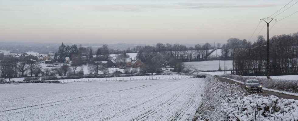
France is still in the grip of a cold spell despite the end of the snowy episode in the plain. Powder snow is still expected in the mountains while in the flats frosts and cold temperatures are expected. The forecasts.
Unexpected, the return of snow in France could also be stealthy. Some falls are still possible in the Mediterranean regions and the north of the country on February 28, but they should lose intensity and become rarer over the hours. The white coat, more or less thick, which covered part of Provence could not be more visible than in the mountains from 1,100 meters above sea level. The Weather Channel predicts “a lot” of snow “from 1,300 meters” from the Pyrenees to the Alps. If the weather signals the end of the snowy episode – which was “significant, but not exceptional” according to meteorologist Patrick Marlière -, the cold has settled in and is widespread in France with negative temperatures or close to 0° in morning despite rare peaks between 7 and 9°C in the southeast. During the day, the mercury should be between 4° and 8° in the northern half and 7° and 12° from the Mediterranean to the Aquitaine Basin. Temperatures that remain lower than normal for the season with nearly 5° missing.
The fault of an anticyclone if France is witnessing the return of snow and cold at the beginning of March. The meteorological phenomenon supplied with very cold air affects France and cools the temperatures explains The Weather Channel. Consequences: low temperatures and frosts of -5°C, or even -6 to -8°C locally are expected upon awakening in the coming days, perhaps until the end of the week.

Snow expected in Lille, Paris, Marseille, Lyon and elsewhere?
The snowy episode that surprised Monday February 27 is over on almost the entire territory. Only a few small falls persist during the day of Tuesday, February 28. The snow will then be scattered and very localized near the Pyrenees, the Black Mountain and the Cévennes. There will also be snow in the southern Alps, near the Italian border, this Wednesday and Thursday, still according to Meteo France.
Paris, Marseille, Lyon and Bordeaux will no longer be covered in snow and Lille could be the last major city to see snow fall on its soil on the morning of February 28. After which the snow will be rare and limited to a few towns such as Tende (Provence-Alpes-Côte d’Azur) or Bonneval sur arc (Auvergne-Rhône-Alpes) where snow is expected possibly until March 2.
This Tuesday, February 28, Météo France warned that the frosts will be “severe” with “between -5 to -7 ° C in Auvergne, -2 to 6 ° C in the South-West, -2 to 5 ° C in the Grand- East, -1 to -3 ° C in the Paris basin, the east of the Pays-de-la-Loire or even the interior of Normandy”.
Snow expected in the mountains
In the mountains, France will also experience snowy episodes, normal for the season. Overview :
- Northern Alps: Snow is forecast for Tuesday in Val d’Isere on Tuesday February 28.
- Southern Alps: Snow is expected from Monday 27 February in the afternoon until Thursday 2 morning in Isola but also in Ceillac, Risoul, Val Pelens and Valberg, but also in Colmiane.
- Pyrenees: In the Pyrenees on the Spanish border, some snowfall is also expected in the evening from Monday February 27 to Tuesday February 28, in particular at the Lers pond, on the Beille plateau and at Font-Romeu, at La Pierre Saint Martin and Piau Engaly.
- Corsica: In Corsica already on orange alert for rain, snow will fall in Vergio and Val d’Else until Friday March 3 morning.
Frosts and freezing cold everywhere in France
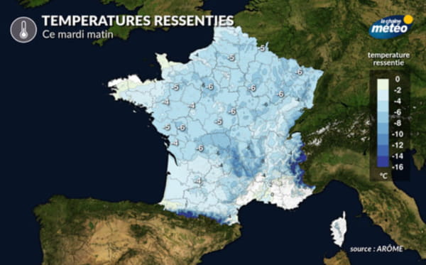
Unlike the snow, the cold is installed at least until the end of the week in France. The anticyclone close to the British Isles throws a cold air over the whole country which is plagued by frosts. “Over the next few days, frosts will be frequent and sometimes quite marked with an average of -4 to -1°C and locally up to -5°C in the countryside” warns La Chaine Météo, according to which only the coastal areas of the Atlantic and the Mediterranean will be spared because they are more cloudy and windy.
The frosts are accompanied by a strong and cold wind which is not without consequences on the feeling of the temperatures. “The temperatures felt will therefore evolve from -6 to -4°C in general, in the morning, where the wind is blowing”, explains the media specialist in the weather. This cold could ease from Friday with winds and less marked frosts.
