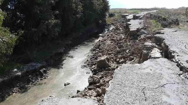
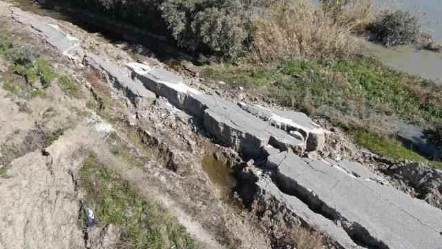
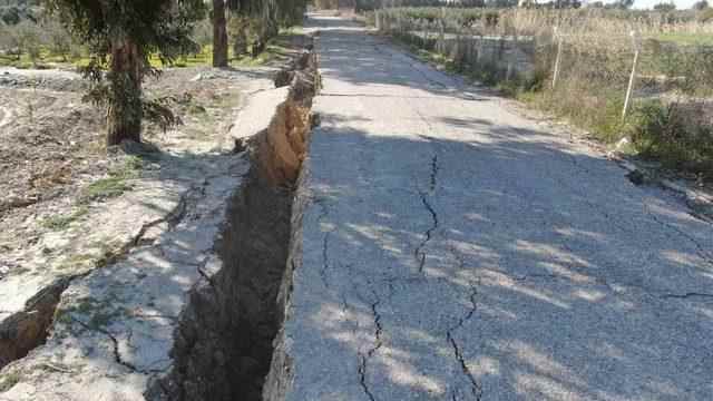
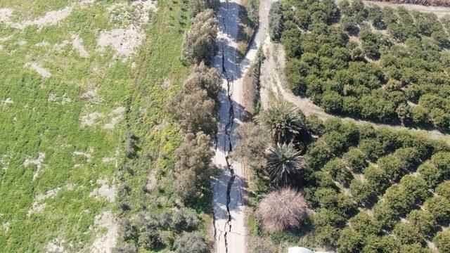
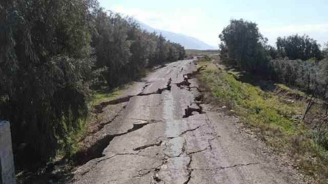
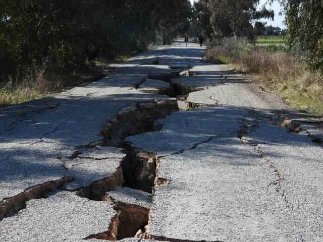
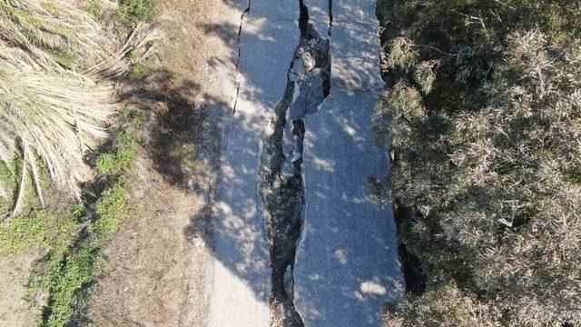
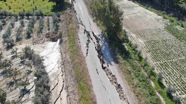
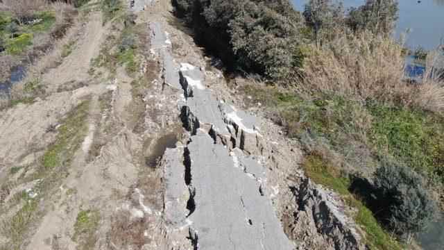
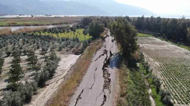
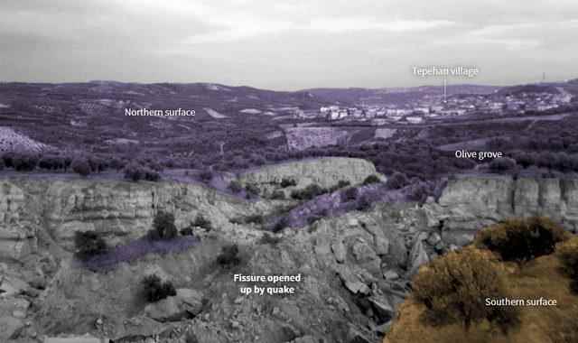
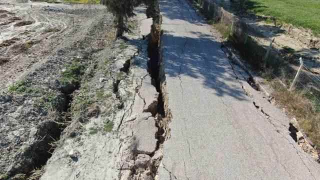
While the cracks in the fault line shook the earth violently, tens of thousands of lives were lost, and the shape of the earth also changed. While the earthquake caused two major ruptures, the land moved up to 7 meters in opposite directions. About 150 km from the epicenter of the first magnitude 7.7 earthquake, in the Tepehan village of Hatay, extraordinary cracks formed on the surface, while a longer fracture stretched for hundreds of kilometers. On the other hand, after the earthquake in the Samandağ district of Hatay, deep crevices and collapses occurred on a road of about 3 kilometers. The road, which reveals the severity of the earthquake, was viewed from the air.
OLIVE FLOOR IS DIVIDED IN TWO
According to the news in Reuters, cracks dividing an olive grove in the village were seen in drone footage taken on February 10.
SAN FRANSISCO HAS BEEN BLASTED! REMEMBERED THE EARTHQUAKE OF 1906
“These were very large and powerful earthquakes that broke up to the surface, occurring on a long series of fault segments,” Eric Fielding, a geophysicist at the Jet Propulsion Laboratory, told NASA’s Earth Observatory site.
Noting that the first earthquake created an extremely strong shaking over a very wide area, Fielding said, “The earthquake’s fracture length and magnitude are similar to the 1906 earthquake that destroyed San Francisco.”
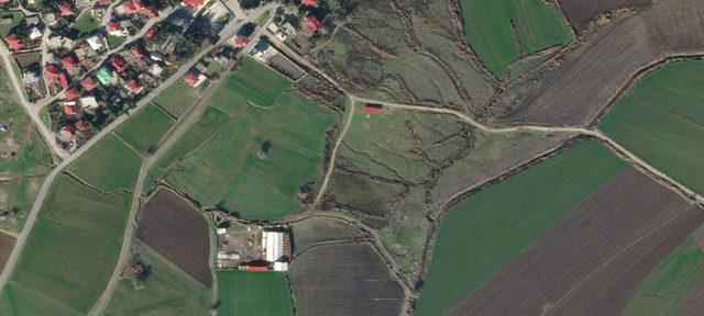
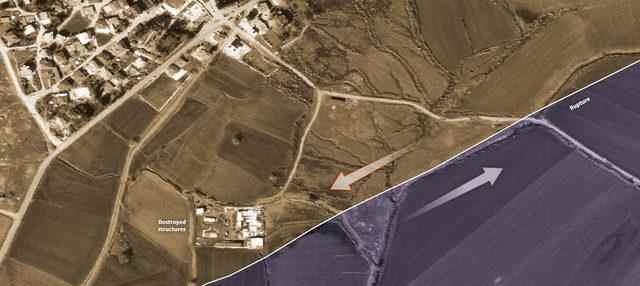
According to data shared by Chris Milliner of the California Institute of Technology, the land on either side of the rifts moved in opposite directions, moving up to 7 meters from its previous location in some places. In the second earthquake, it was observed that the land was displaced up to 5 meters from place to place.
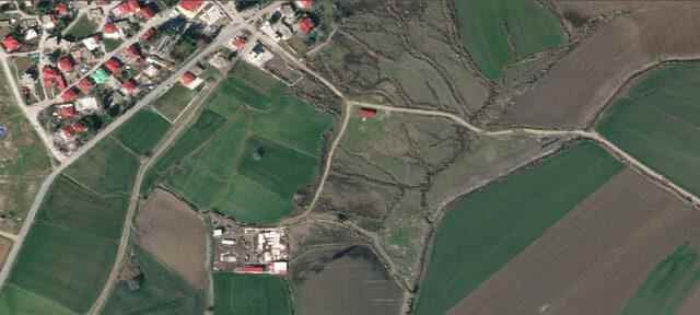
THROUGH THE MIDDLE OF THE VILLAGE!
Satellite images from Planet Labs revealed the displacement on the surface. The images show a surface rupture that runs through the center of a village near Nurdağı and is clearly visible as the ground has moved several meters on either side.
SCARY VIEWS IN HATAY
Two major earthquakes in Kahramanmaraş had a devastating effect on Hatay.
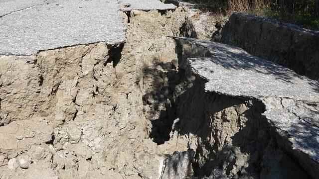
Deep crevices and collapses occurred on the approximately 3-kilometer road that leads to the point where the Orontes River meets the sea, located in Yeni Mahallesi Liman Street in the Samandağ district.
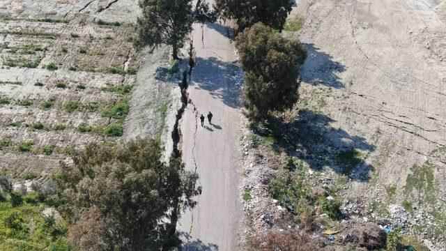
The road, which reveals the magnitude of the earthquake, was viewed from the air.
Habib Kaptan, a resident of the neighborhood, said, “My mother is 95 years old. I asked my mother if there was such an earthquake before. She said, “I have never seen such an earthquake in my life.” .
