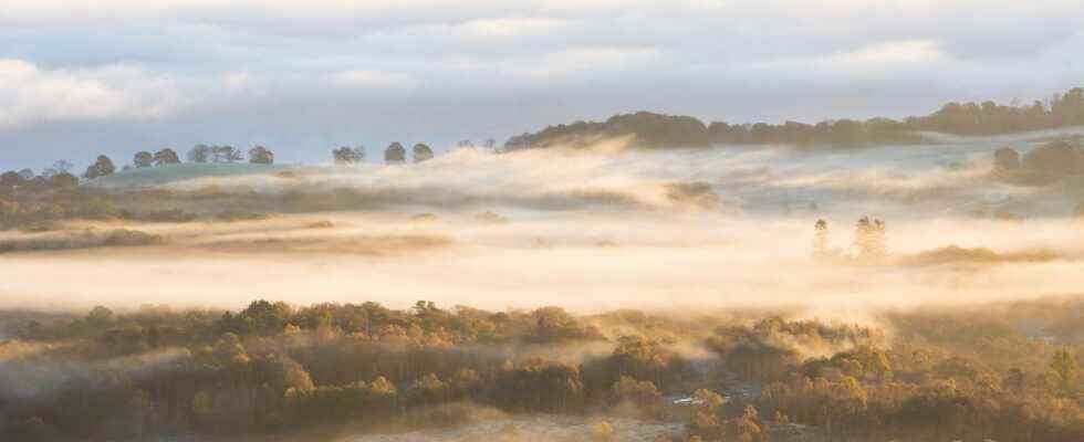
During a night temperature inversion, the cold air is blocked on the floor by a warmer air cover. © danielkay, Adobe Stock
Temperature inversion refers to a meteorological phenomenon in which a layer ofair warm looms over cold air in a given layer of the atmosphere. In the troposphere (up to 11 to 12 km altitude at latitudes temperate), the temperature decreases with altitude (on average 6.5 ° C per km), due to the decrease in pressure, which results in dilation and therefore cooling of the air. But in certain circumstances, the phenomenon is sometimes reversed.
The nocturnal inversion
THE’winter, when the weather is cold and clear, the solar radiation warms the ground during the day. At night, the absence of cloud cover causes the ground to cool rapidly, where a layer of cold, heavier air is formed, which remains blocked by the hot air cover. This situation often results in the formation of fog and low clouds (the famous “Seas of cloudsWhich you can see above valleys when you are in the mountains). In addition, by blocking the convection vertical air, the latter remains trapped, which aggravates the effects of atmospheric pollution, especially in the absence of wind. This is what explains many pollution peaks in winter.
Subsidence reversal
The inversion of subsidence is observed between 1,000 and 2,000 meters above sea level. It occurs during high pressure period and results from a “packing” of the cold air on itself. This compression adiabatic heats up the upper layer of the atmosphere, which descends until it reaches a certain altitude, where it becomes trapped above a layer of colder air, forming a “bell” above this lower layer. Reversal of subsidence is more common on northern continents in winter and in subtropical oceans, where large highs are found.
Frontal inversion
This type of temperature inversion is formed when a warm, humid front arrives and cuts a cold front. As warm air has a lower density, it takes some time to expel it, initially “slipping” above it. A temporary temperature inversion occurs above a certain point. Unlike other types of inversion, frontal inversion is not confined to a single layer of the atmosphere but extends over the entire surface of the front.
The reversal of the trade winds
It is a perennial form of the inversion of subsidence, generated by the superposition of humid air transported by the trade winds with a layer of hot, dry air.
The temperature inversion ends when the anticyclone is weakened, or by the arrival of a front with accompanied by movements sufficiently strong convectives. This phenomenon is typical of the troposphere, because beyond 12 km, the inversion of the gradient thermal is permanent.
You will also be interested
Interested in what you just read?
.
fs12