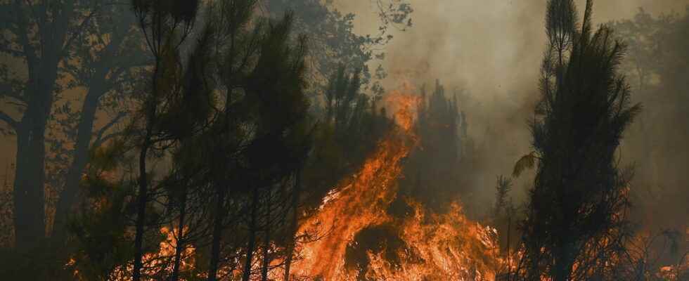
FINISTERE FIRE. Around Brasparts (Finistère), in Brittany, the fire continues to gain ground. Firefighters are trying to contain the spread of the fire. The latest info.
[Mise à jour le 19 juillet à 15h14] It is a fire “of a fairly unprecedented scale” facing Brittany. By the very admission of the sub-prefect of Finistère, Claire Maynadier, the fire that the firefighters continue to fight on the side of Brasparts, in the Monts d’Arrée, this Tuesday July 19, 2022, is historic. Since Monday, the flames have been ravaging this Breton massif, nestled in the heart of the Armorique regional park, east of Brest. “We entered a combat sequence. It is a question of stopping, of controlling the progression of the fire”, explained the prefect of Finistère, Philippe Mahé, during a press briefing organized Tuesday at midday.
However, the flames are gaining ground in this part of the Breton tip. Nearly 1500 hectares have already burned in 24 hours, the equivalent of more than 2000 football fields. Above all, the fire should still wreak havoc for several hours. “It will not be over tonight” warned the firefighters, even if the latter “hope[nt] that the fire will be fixed in the evening”, according to the words of Gilles Boulic, commander of the rescue operations, during this same press briefing. However, the winds move the fire towards the north and do not facilitate the operations, which mobilize already 260 firefighters and 50 machines, which were briefly supported by a canadair.
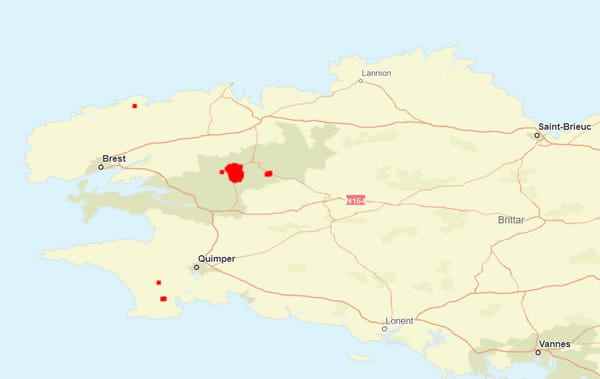
The fire that broke out in Brittany, in the Monts d’Arrée (Finistère), has so far caused no casualties. No injuries are also to be deplored. However, just over 500 people had to leave their homes, according to the latest count announced by the Finistère prefecture mid-morning on Tuesday. They were residents of Botmeur, a town north of Brasparts (see map below), as well as three surrounding hamlets. The damage concerns, for the moment, only the vegetation currently in the grip of the flames. No homes were affected by the fire.
Map of the fire in the Monts d’Arrée
The fire that has struck the Monts d’Arrée since Monday July 18, 2022 therefore broke out in the town of Brasparts, in Finistère, located 50km east of Brest, in the heart of the Armorique regional park. The fire (in red on the map) continues to move due to the gusts of wind expected during the day on Tuesday. If firefighters are trying to limit the spread of the fire in Finistère, the swirling winds have allowed the flames to spread. “The fire started south of the Chapel of Mont-Saint Michel de Brasparts and is spreading north, west and east,” said the sub-prefect of Châteaulin, Claire Maynadier, on Tuesday.
Images of the fire in Brittany
In Brittany, the flames also spread very quickly through the vegetation. Several images make it possible to realize, already, the extent of the fire, but also the damage it causes, broadcast in particular by local journalists from daily newspapers West France and Telegram.
What is the origin of the fire in the Monts d’Arrée?
Why did a fire in turn break out in Brittany? With the period of high heat, the authorities had warned of the very high risk of fires starting in France, calling for vigilance. Is it a human fault or not that triggered the appearance of the flames in the Monts d’Arrée? For the time being, the prefecture of Finistère indicates that the cause is not yet known and no lead seems to be favored at this stage.

