A roller cloud, more or less jagged, sometimes appears in front of the most violent storms: it is the arcus, one of the most impressive clouds on the planet.
This cloudy steamroller-like phenomenon can cause panic among those who do not know it, but also among those who know it! The arcus generally announces the arrival of violent phenomena in an imminent way, and at its approach, it is better to take shelter as soon as possible. It is also the cloud the most photographed during stormy degradations, so spectacular is its arrival, especially if it occurs at sunrise or sunset Sun. It manifests itself in the form of a horizontal roll, dense, having more or less frayed edges. The most jagged arcs give the impression of a tsunami of clouds crashing down on Earth.
It sits ahead of the lower part of the cumulonimbus clouds and when extended takes on the appearance of a dark, menacing arc, giving the sky a truly apocalyptic look. He may even appear to be detached from the storm cloud, when he is actually part of it. But what is most surprising about this bow is that it rolls on itself! This movement clearly visible toeye naked testifies to his arrival at large speed : it indeed advances at an average of 70 km/h. It stretches over tens of kilometers and is close to the ground: a few hundred meters high, and therefore plunges cities into darkness for a few minutes. The arcus is a sign of great instability, it is often accompanied by intense precipitation, lightning, strong winds (sometimes more than 100 km/h) and hail.
This form of roll cloud is due to wind shear (the variation in speed and direction of the winds). The storm cloud generates a current ofair cold towards the ground, while the warm air from the ground continues to rise in altitude: the warm air is then lifted by the cold air, and the layer of clouds wraps horizontally and gradually stretches in the form of a roll . This roller begins to rotate on itself and is slightly separated from the main storm cloud by the gust front. This arc, which therefore descends very low, is shredded when the gust front, the area in front of the storm that pushes very strong winds towards the ground, is so powerful that it cuts the cloud into shreds. The more it is shredded, the more violent the events it produces.
In the strongest stormsthe arcus can be multilayered: several arcs are superimposed on each other, a rare phenomenon in France and more common in the great American plains.
Multilayer Arcus in the Puy-de-Dôme in 2018. © Lothar
It sometimes happens that arcus do not generate violent phenomena: it is in fact an arcus at the end of its life when it arrives at you. These arcus skeletons do not take long to break up, sometimes accompanied by a downpour, and sign the end of the storm in question. The arcus is a common phenomenon during stormy degradations all over the world, but it is difficult to photograph in its entirety, you have to be several tens of kilometers away, often 30 or 50 kilometers and on open ground to photograph it in totality.
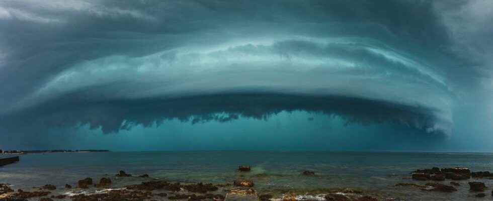
Spectacular arcus at sunset in Belgium in 2013. © Herreman Jonathan
Do you want to access Futura without being interrupted by advertising?
Discover our online subscriptions and browse without ads! At this moment, the Mag Futura is offered for a 3-month subscription to the subscription “I participate in the life of Futura”!

What is Mag Futura?
- Our first paper journal of more than 200 pages to make science accessible to as many people as possible
- A dive into the heart of 4 scientific themes that will mark 2022, from the Earth to the Moon
*Mag Futura is sent after the third month of registration.
Interested in what you just read?