On May 29, 2007, Google inaugurated a service on the scale of its disproportionate ambitions: Street View. By a small blog note accompanied a funny videothe search giant supplemented Maps – launched two years earlier – with this revolutionary function, which was to fascinate Internet users for a long time.
Fifteen years later, Street View cars have been driven extensively. The service, initially limited to five American cities, now covers more than 16 million kilometers in a hundred countries. With more than 220 billion geolocated 360-degree images, Street View “is one of the largest databases in the world”, detailed Gilles Dawidowicz, geographer at Google France, during a press briefing yesterday. .
And Google is not resting on its laurels. He is taking advantage of this anniversary to refine his service, a few days after unveiling Immersive View during the I/O conference.
First with the arrival on smartphone of a function until now only available on the desktop version: the history of shots. You will be able to “travel in time” and consult all the photos recorded by Google on a given place… and thus discover the evolution of your city, your district, over the years.
This function will be available on both iOS and Android, and its deployment begins today.
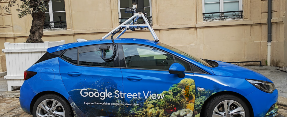
A new modular camera
The American giant intends to continue to grow this gigantic database. He who has already placed his capture equipment on snowmobiles or camels also presents a new camera, much lighter (less than seven kilos) and modular. It can therefore be easily carried over long distances and easily attached to any vehicle.
It will also allow Google to simplify its car shots. No need for equipment in the vehicle cabin, because this camera integrates all the intelligence necessary for image processing. In addition, a simple roof rack is enough to secure it.
“This flexibility will make image collection easier for our partners around the world and allow us to explore greener solutions for our current fleet, such as plug-in hybrid vehicles or fully electric vehicles,” Google said in a statement.
Street view at Maps data service
We also learn on the occasion of this anniversary how useful Street View images are to Maps. Google uses this gigantic fund to constantly improve the data of its mapping tool, through image analysis tools: opening or closing of shops, opening hours, speed limit signs… Google has since carried out three years 25 billion updates of Maps thanks to the photos of the roads of the whole world!