In the afternoon of this Monday, March 13, more than twenty departments will be placed on thunderstorm vigilance according to Météo France. A violent and unusual event for the season against which we should be careful.
It is a violent and above all unusual stormy episode for the season. France will be hit, in the afternoon of Monday March 13, 2023, by major weather disturbances combining strong winds, heavy rains and hail in places. No less than 21 departments are affected by storm orange vigilance deployed by Meteo France from 3 p.m. until mid-evening around 10 p.m. If a few showers occurred during the first half of March, the storms that are preparing are not usually expected until spring, new proof – if one was needed – of climate change. Moreover, the surprise is such that meteorologists have “still uncertainties about the intensity of the strongest storms and their extension”. Still, the meteorological event “requires particular vigilance given the risk of associated intense phenomena”.
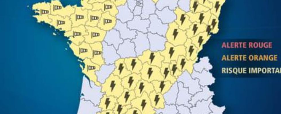
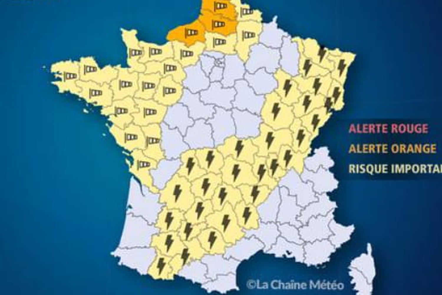
Which departments are on storm orange vigilance?
Orange vigilance will cross France to the northeast or southwest with 21 departments placed on orange alert: Haut-Rhin, Vosges, Haute-Marne, Territoire de Belfort, Haute-Saône, Côte-d ‘Or, the Doubs, the Jura, the Nièvre, the Saône-et-Loire, the Allier, the Puy-de-Dome, the Loire, the Corrèze, the Cantal, the Lot, the Aveyron, the Tarn, the Tarn-et-Garonne, Haute-Garonne and Ariège.
To this already long list is added all the French departments concerned by a yellow vigilance for winds, avalanches and/or floods.
What are the forecasts and what are the risks for storm orange vigilance?
Storms will break out in the middle of the afternoon over the Southwest, the Massif Central and as far as Burgundy. The lightning and the thunder will then move gradually eastward in the late afternoon and during the evening. The storms will be accompanied by “violent gusts of wind that can locally exceed 90 to 100 km / h”, according to the morning bulletin of Météo France. The winds will be joined at times by “temporarily sustained” showers, which could bring up to 20 to 30 mm of rain and little weather. However, the water could have difficulty flowing due to the dryness of the soil and lead to flooding in the streets.
Locally, the rains could give way to hailstorms. Faced with winds, showers and the risk of flooding and/or flooding, Météo France calls for the greatest vigilance. It is recommended to stay away from trees and waterways and to limit your movements. Caution is required for the whole country, because the list of vigilances is likely to evolve over the day.