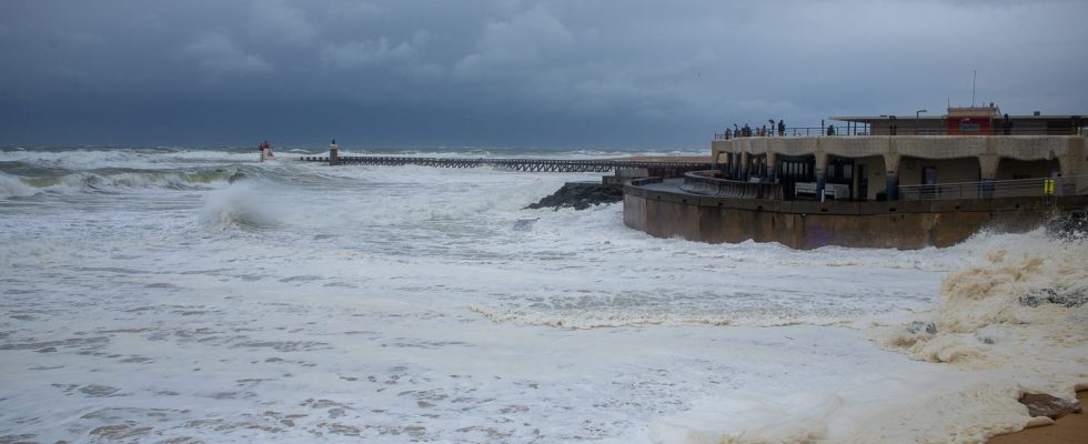
This Monday, two departments are placed on orange alert for flooding. The Channel coasts and the Arcachon Basin will be subject to heavy rain.
In its latest bulletin published this Monday, February 26 in the morning, Météo-France warns of a “depression circulating over France which will be accompanied by a strong north to northeast wind along the Channel coasts”, and a strong north wind on the Atlantic coast. The associated strong waves could cause submersion by crossing sea waves on exposed areas of the Channel coast and erosion on the coast of the Bay of Biscay.
Pas-de-Calais and Gironde placed on orange flood alert
This Monday, it seems that the yellow alert level is sufficient and a worsening of the alert level therefore becomes very unlikely for the wave-submersion phenomenon. Particular attention will however need to be paid around the Arcachon basin where the flow of heavy rain this Sunday may be thwarted by high sea levels at high tide.
Traffic conditions may be made difficult across the entire network and disruptions may affect rail transport, power cuts may occur and dykes may be weakened or submerged due to these floods. This is why the departments of Pas-de-Calais and Gironde are placed on orange alert for floods, they are the only two departments in France in this case this Monday.
A rainy day and winds up to 100 km/h
In general, another rainy day is expected over a large part of the country. East of the Rhône and in Corsica, the weather remains overcast and rainy with snow from 1200 m in the Alps. Accumulated precipitation over the day can locally go up to 80 to 100 mm on the coast of the Alpes Maritimes.
Furthermore, a rainy return is planned during the day from Brittany to Hauts de France via Normandy, it will reach the Pays de la Loire and Île-de-France during the afternoon. The northeast wind blows at 80 to 100 km/h in gusts along the Channel coast. In the rest of the country, the weather is unstable with showers at times, more frequent in the afternoon, particularly in New Aquitaine.
