For this Tuesday, April 9, Météo France is warning of storm Pierrick which will still affect 11 departments. Temperatures will also drop everywhere in France.
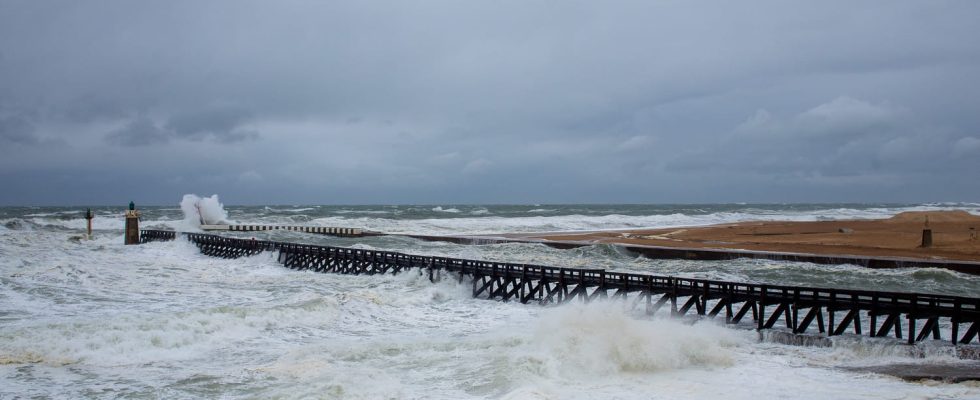
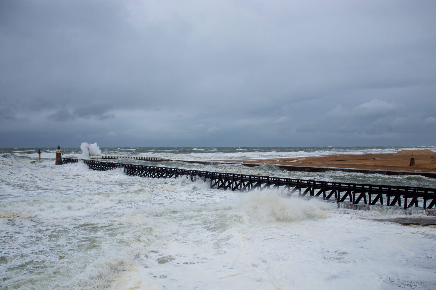
Météo-France placed this Monday afternoon from 4 p.m., following the Pierrick depression, five departments on orange alert for risks of “floods: Charente-Maritime, Pyrénées-Atlantiques, Seine-Maritime, Gironde and the Eure. For its part, Finistère is on orange alert for “wind” and “submersion waves” at the end of the afternoon.
The trend is confirmed on Tuesday. These six departments will, in fact, be joined by Pas-de-Calais, Manche, Ille-et-Vilaine, Somme and Côtes d’Armor on orange alert for “submersion waves”. “The Pierrick depression is circulating a little further north than initially envisaged. The gusts will therefore be a little less strong than previously expected but we must remain vigilant,” said Météo-France.
With the storm, cold air will invade the country this Tuesday. A fall of up to 10 degrees locally is forecast for April 9. Snow will also return to the mountains from 1000 meters. Only the Mediterranean regions will still be above the 15 degree mark, temperatures a little below seasonal norms.
A storm that rises
The wind blew very strongly from Brittany to the Channel coasts this Monday. A depression formed off the coast of Portugal on Sunday. This storm named Pierrick rose at high speed towards Brittany this Monday, carried by a very dynamic jet stream at 200 km/h from the southwest. Strong gales were expected according to La Chaîne Météo, with gusts reaching 90 to 110 km/h.
This is why a risk of coastal submersion was present in the area, at the time of high water. Waves of 4 to 6 meters will propagate on the coast. And that’s not all. Hot air coming from the Maghreb will confront this strong disturbance in France.
Thunderstorms will therefore form this Monday evening, from the Pyrenees towards the center of the country. They could be accompanied by hail and brutal gusts of wind, particularly in Finistère, a department placed on orange wind alert this Monday, April 8, 2024. The first storms broke out in Lot-et-Garonne and Limousin, which has already caused significant precipitation and lightning in places. The Weather Channel has given its alert forecasts, valid until 9 a.m. Tuesday.

The situation did not improve in the evening. Winds will reach up to 120 km/h on the coasts of Finistère. “Virulent” storms occasionally accompanied by hail could be observed between the Pyrenees and the central regions. In total, no less than 21 departments are placed at significant risk for thunderstorms this Monday and 4 are on orange alert: Corrèze, Creuse, Dordogne and Lot-et-Garonne. In the north-western quarter of the country, 11 departments have been placed at significant wind risk. Finistère is still on orange alert.